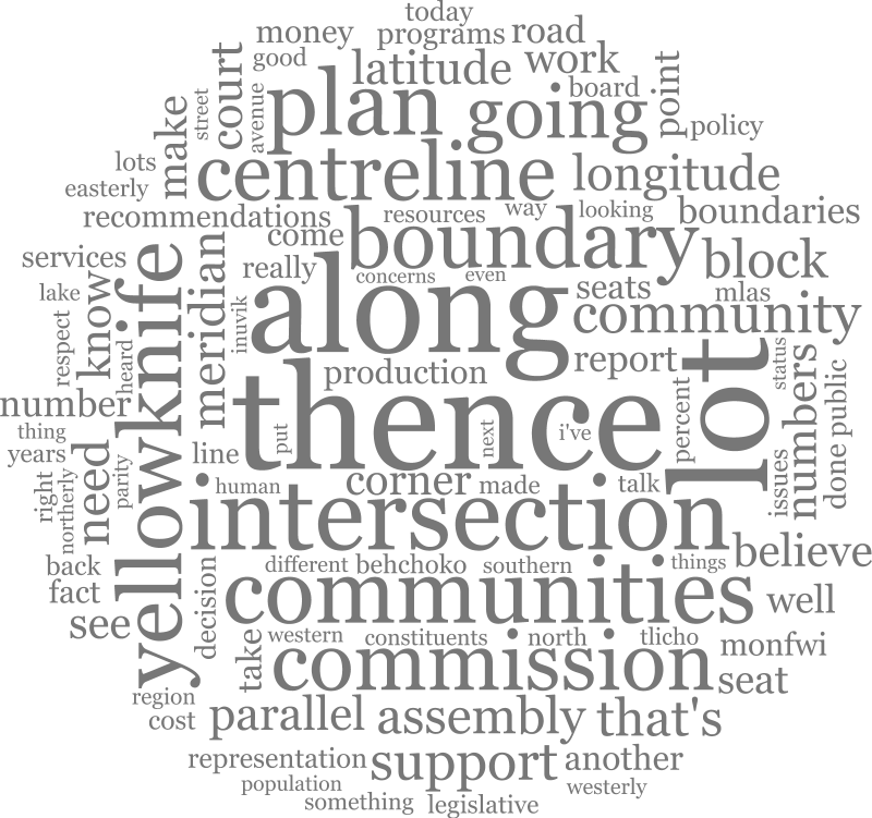
Thank you, Mr. Hawkins. The Member is seeking unanimous consent to have the schedule to the motion be read and printed in Hansard in its entirety. Are there any nays? There are no nays.
Schedule
12. Behchoko
Consisting of all that portion of the Northwest Territories bounded as follows: Commencing at the intersection of the 116(05( meridian of longitude and the 62(53( parallel of latitude; thence east along the 62(53( parallel of latitude to its intersection with the 115(55( meridian of longitude; thence south along the 115(55( meridian of longitude to its intersection with the 62(49( parallel of latitude; thence west along the 62(49( parallel of latitude to its intersection with the 116(05( meridian of longitude; thence north along the 116(05( meridian of longitude to the point of commencement.
13. Monfwi
Consisting of all that portion of the Northwest Territories bounded as follows: Commencing at the intersection of the 65th parallel of latitude and the 120th meridian of longitude; thence south along the 120th meridian of longitude to its intersection with the 62(15( parallel of latitude; thence east along the 62(15( parallel of latitude to its intersection with the 114(20( meridian of longitude; thence north along the 114(20( meridian of longitude to its intersection with the 62(24(30( parallel of latitude; thence west along the 62(24(30( parallel of latitude to its intersection with the 114(31( meridian of longitude; thence north along the 114(31( meridian of longitude to its intersection with the 62(30( parallel of latitude; thence east along the 62(30( parallel of latitude to its intersection with the 114(26( meridian of longitude; thence north along the 114(26( meridian of longitude to its intersection with the 62(55( parallel of latitude; thence east along the 62(55( parallel of latitude to its intersection with the 112(30( meridian of longitude; thence north along the 112(30( meridian of longitude to its intersection with the Nunavut-Northwest Territories boundary (Lat. 65(30( N; Long. 112(30( W); thence northwesterly along that boundary to its intersection with the 116(00( meridian of longitude at the 66(40( parallel of latitude, approximately; thence south along the 116(00( meridian of longitude to its intersection with the 65th parallel of latitude; thence west along the 65th parallel of latitude to the point of commencement.
Excluding the electoral district of Behchok".
14. Weledeh
All plans referred to in this description are deposited in the Land Titles Office for the Northwest Territories Land Registration District in Yellowknife.
Consisting of all that portion of the Northwest Territories bounded as follows: Commencing at the intersection of the 62(55( parallel of latitude and the 114(26( meridian of longitude; thence south along the 114(26( meridian of longitude to its intersection with the 62(30( parallel of latitude; thence east along the 62(30( parallel of latitude to its intersection with the centreline of Ingraham Trail Highway No. 4; thence southerly along the centreline of Ingraham Trail Highway No. 4 to its intersection with the westerly production of the northern boundary of Lot 40, Block 308, Plan 3953; thence easterly along that production and continuing along the northern boundary of Lot 40, the easterly boundary of Lot 10, Block 307, Plan 3953, and the easterly boundary of Lot 1090, Plan 2732, to the northwestern corner of a utility right-of-way, Plan 621; thence southerly along the western boundary of the utility right-of-way to its intersection with the centreline of 44th Street; thence southeasterly along the centreline of 44th Street to its intersection with the centreline of 52nd Avenue; thence southerly along the centreline of 52nd Avenue to its intersection with the northwesterly production of the southwestern boundary of Lot 3, Block 167, Plan 3767; thence southeasterly along that production, the southwestern boundary of Lot 3, the western and southern boundary of Lot 1, Block 91, Plan 3506, the southern boundary of Block 91 remainder, Plan 484, and its easterly production to its intersection with the centreline of School Draw Avenue; thence northerly along the centreline of School Draw Avenue to its intersection with the centreline of 44th Street; thence westerly along the centreline of 44th Street to its intersection with the southerly production of the western boundary of Lot 1, Block 93, Plan 482; thence northerly along that production, the western boundary of Lots 1 to 6 and southerly along the eastern boundary of Lot 6 to the northeastern corner of Lot 6; thence northeast in a straight line to the northern corner of Lot 1, Block 94, Plan 482; thence easterly in a straight line to the intersection of that line and the western shore of Great Slave Lake at the 62(27(20( parallel of latitude and the 114(21(18( meridian of longitude, approximately; thence east along the 62(27(20( parallel of latitude to its intersection with the 114(20( meridian of longitude; thence south along the 114(20( meridian of longitude to its intersection with the 62(15( parallel of latitude; thence east along the 62(15( parallel of latitude to its intersection with the 112(30( meridian of longitude; thence north along the 112(30( meridian of longitude to its intersection with the 62(55( parallel of latitude; thence west along the 62(55( parallel of latitude to the point of commencement.
15. Frame Lake
All plans referred to in this description are deposited in the Land Titles Office for the Northwest Territories Land Registration District in Yellowknife.
Consisting of all that portion of the Northwest Territories bounded as follows: Commencing at the intersection of the 114(26( meridian of longitude and the 62(30( parallel of latitude; thence south along the 114(26( meridian of longitude to its intersection with the centreline of Yellowknife Highway No. 3; thence easterly along the
centreline of Yellowknife Highway No. 3 to its intersection with the centreline of Old Airport Road; thence southerly to the northwestern corner of Lot 927, Group 964, Plan 1005; thence southerly along the eastern boundary of Old Airport Road to the southwest corner of Lot 919, Group 964, Plan 1005; thence easterly along the northern boundary of Cemetery Road to its intersection with the western corner of Lot 906, Group 964, Plan 1005; thence southeasterly along the southwestern boundary of Lot 906, Group 964 to the southern corner of Lot 906, Group 964, Plan 1005; thence westerly in a straight line to the southeast corner of Lot 40, Plan 2043; thence westerly along the southern boundary of Lot 40, Plan 2043 to the southeast corner of Lot 4, Plan 515; thence southerly along the eastern boundary of Lots 5, 6 and 7, Plan 515, Lots 8 and 9, Plan 1223, Lots 35 and 36, Plan 1340, Lots 11, 12 and 13, Plan 515, Lots 14-1 and 14-2, Plan 1191, Lots 15, 16 and 17, Plan 515 and Lot 42, a limit of Old Airport Road and Lot 1, Block 371, Plan 2249 to the eastern corner of Lot 1, Block 371; thence continuing southeasterly on a production of the eastern limit of Lot 1, Block 371 to its intersection with the shore of Frame Lake; thence southerly, easterly and northerly along the shore of Frame Lake to the northern corner of Lot 2, Block 122, Plan 2015; thence southerly along the eastern boundary of Lot 2, Block 122 to the easterly corner of Lot 2, Block 122; thence southeasterly in a straight line to the intersection of the centreline of 50th Avenue and the centreline of Reservoir Road; thence south along the centreline of Reservoir Road to its intersection with the centreline of Forrest Drive; thence southerly in a straight line to the northwestern corner of Unit 1, Lot 21, Block 133, Plan C-2277; thence southerly along the western boundary of Units 1 to 12 and easterly along the south boundary of Lot 21, Block 133, Plan C-2277 to the southeastern corner of Lot 21; thence southeasterly in a straight line to the northwestern corner of Lot 24, Block 133, Plan 3850; thence southerly and easterly along the western and southern boundary of Lot 24 and southern boundary of Lots 1, 2 and 26, Block 146, Plan 863 to the southern corner of Lot 26, Block 146, Plan 863; thence easterly in a straight line to the southwestern corner of Lot 27, Block 146, Plan 863; thence easterly along the southern boundary of Lots 27 and 25, Block 146, Plan 863, and the northeasterly production of the southeastern boundary of Lot 25 to the intersection of that production and the centreline of Con Road; thence northwesterly and northerly along the centreline of Con Road to its intersection with the centreline of 55th Street; thence northwesterly along the centreline of 55th Street to its intersection with the centreline of 51st Avenue; thence northeasterly along the centreline of 51st Avenue to its intersection with the centreline of 54th Street; thence northwesterly along the centreline of 54th Street to its intersection with the centreline of 50th Avenue; thence northeasterly along the centreline of 50th Avenue to its intersection with the centreline of 53rd Street; thence northwesterly along the centreline of 53rd Street to its intersection with the easterly production of the north boundary of Lots 28 and 29, Block 27, Plan 1388; thence westerly along that production, the northern boundary of Lots 28 and 29, Block 27, Plan 1388, and the northern boundary of Lots 24, 25, and 26, Block 27, Plan 217, to the western corner of Lot 26; thence northwesterly along the northeastern boundary of Lot 1, Block 118, Plan 634 and the northeastern limit of a road right-of-way, Plan 634 to the northern corner of that right-of-way; thence northeasterly to the western corner of Lot 11, Block 49, Plan 1940; thence along the northern boundary of Lots 11 and 12, Block 49, Plan 1940 and the easterly production of Lot 12, Block 49, Plan 1940, to the intersection of that production and the centreline of Ingraham Trail Highway No. 4; thence northerly along the centreline of Ingraham Trail Highway No. 4 to its intersection with the 62(30( parallel of latitude; thence west along the 62(30( parallel of latitude to the point of commencement.
16. Range Lake
All plans referred to in this description are deposited in the Land Titles Office for the Northwest Territories Land Registration District in Yellowknife.
Consisting of all that portion of the Northwest Territories bounded as follows: Commencing at the intersection of the 114(26( meridian of longitude and the 62(30( parallel of latitude; thence south along the 114(26( meridian of longitude to its intersection with the centreline of Yellowknife Highway No. 3; thence easterly along the centreline of Yellowknife Highway No. 3 to its intersection with the centreline of Old Airport Road; thence southerly to the northwestern corner of Lot 927, Group 964, Plan 1005; thence southerly along the eastern boundary of Old Airport Road to the southwest corner of Lot 919, Group 964, Plan 1005; thence easterly along the northern boundary of Cemetery Road to its intersection with the western corner of Lot 906, Group 964, Plan 1005; thence southeasterly along the southwestern boundary of Lot 906, Group 964 to the southern corner of Lot 906, Group 964, Plan 1005; thence westerly in a straight line to the southeast corner of Lot 40, Plan 2043; thence westerly along the southern boundary of Lot 40, Plan 2043 to the southeast corner of Lot 4, Plan 515; thence southerly along the eastern boundary of Lots 5, 6 and 7, Plan 515, Lots 8 and 9, Plan 1223, Lots 35 and 36, Plan 1340, Lots 11, 12 and 13, Plan 515, Lots 14-1 and 14-2, Plan 1191, Lots 15, 16 and 17, Plan 515 and Lot 42 and the northern limit of a short portion of Old Airport Road to the midpoint, said midpoint being the centreline of Old Airport Road; thence southwesterly along the centreline of Old Airport Road to its intersection with the centreline of Range Lake Road; thence southwesterly along the centreline of Range Lake Road to its intersection with the southeasterly production of the northeastern boundary of Lot 6, Block 560, Plan 2108; thence northwesterly along that production and the northeastern boundary of Lot 6 to the northern corner of Lot 6, said point also being on the southern boundary of Lot 971, Plan 1069; thence southwesterly and northwesterly along the southwestern boundary of Lot 971 to the western corner of Lot 971, said point also being the northern point of Lot 6, Block 550, Plan 1971; thence southwesterly and southerly along the northern and western boundary of Lot 6 to the southern corner of Lot 2, Plan 4052; thence westerly and northerly along the boundary of Lot 2 to its intersection with Lot 1048, Plan 2148; thence westerly, northerly, and easterly along the boundary of Lot 1048 to its intersection with Lot 1, Plan 3720; thence northerly, northwesterly, and along a northwesterly production of the western boundary of Lot 1 to its intersection with the centreline of Highway No. 3; thence westerly along the centerline of Highway No. 3 to its intersection with the 114(31( meridian of longitude; thence north along the 114(31( meridian of longitude to its intersection with the 62(30( parallel of latitude; thence east along the 62(30( parallel of latitude to the point of commencement.
17. Trappers Lake
All plans referred to in this description are deposited in the Land Titles Office for the Northwest Territories Land Registration District in Yellowknife.
Consisting of all that portion of the Northwest Territories bounded as follows: Commencing at the intersection of the 114(31( meridian of longitude and the 62(24(30( parallel of latitude; thence northeasterly in a straight line to the northern corner of Lot 48, Block 553, Plan 3870, said point also being on the southwestern boundary of Lot 6, Block 550, Plan 1971; thence southeasterly along the southwestern boundary of Lot 6, and the southwestern boundary of Lot 31, Block 546, Plan 1799 and northeasterly along the southeastern boundary of Lot 31 to the eastern corner of Lot 31; thence northeasterly to its intersection of the centrelines of each of Balsillie Court and Bagon Drive; thence northerly along the centreline of Bagon Drive to its intersection with the centreline of Hordal Road; thence northeasterly along the centreline of Hordal Road to its intersection with the centreline of Range Lake Road; thence northerly along the centreline of Range Lake Road to its intersection with the southeasterly production of the northeastern boundary of Lot 6, Block 560, Plan 2108; thence northwesterly along that production and the northeastern boundary of Lot 6 to the northern corner of Lot 6, said point also being on the southern boundary of Lot 971, Plan 1069; thence southwesterly and northwesterly along the southwestern boundary of Lot 971 to the western corner of Lot 971, said point also being the northern point of Lot 6, Block 550, Plan 1971; thence southwesterly and southerly along the northern and western boundary of Lot 6 to the southern corner of Lot 2, Plan 4052; thence westerly and northerly along the east boundary of Lot 2 to its intersection with Lot 1048, Plan 2148; thence westerly, northerly and easterly along the boundary of Lot 1048 to its intersection with Lot 1, Plan 3720; thence northerly, northwesterly, and along a northwesterly production of the western boundary of Lot 1 to its intersection with the centreline of Yellowknife Highway No. 3; thence westerly along the centerline of Yellowknife Highway No. 3 to its intersection with the 114(31( meridian of longitude; thence south along the 114(31( meridian of longitude to the point of commencement.
18. Kam Lake
All plans referred to in this description are deposited in the Land Titles Office for the Northwest Territories Land Registration District in Yellowknife.
Consisting of all that portion of the Northwest Territories bounded as follows: Commencing at the intersection of the 114(31( meridian of longitude with the 62(24(30( parallel of latitude; thence northeasterly along a straight line to the northern corner of Lot 48, Block 553, Plan 3870, said point also being on the southwestern boundary of Lot 6, Block 550, Plan 1971; thence southeasterly along the southwestern boundary of Lot 6, and the southwestern boundary of Lot 31, Block 546, Plan 1799 and northeasterly along the southeastern boundary of Lot 31 to the eastern corner of Lot 31; thence northeasterly to the intersection of the centrelines of each of Balsillie Court and Bagon Drive; thence northerly along the centreline of Bagon Drive to its intersection with the centreline of Hordal Road; thence northeasterly along the centreline of Hordal Road to its intersection with the centreline of Range Lake Road; thence northerly along the centreline of Range Lake Road to its intersection with the centreline of Woolgar Avenue; thence southeasterly along the centreline of Woolgar Avenue to its intersection with the centreline of Kam Lake Road; thence southwesterly along the centreline of Kam Lake Road to its intersection with the westerly production of the southern boundary of Lot 2, Block 500, Plan 2144; thence easterly along that production, the southern boundary of Lot 2, the northern boundary of Lot 922, Plan 727, and the southern boundary of Lot 1002, Plan 1296, to a deflection point on the south boundary of Lot 1002; thence southeasterly in a straight line to the intersection of the 114(23(30( meridian of longitude and the 62(24(30( parallel of latitude; thence westerly in a straight line to the point of commencement.
19. Pud Lake
All plans referred to in this description are deposited in the Land Titles Office for the Northwest Territories Land Registration District in Yellowknife.
Consisting of all that portion of the Northwest Territories bounded as follows: Commencing at the intersection of the 114(20( meridian of longitude and the 62(26(38( parallel of latitude; thence westerly in a straight line to the intersection of the centreline of Con Road and the northeasterly production of the southeastern boundary of Lot 25, Block 146, Plan 863; thence westerly along that production, the southern boundary of Lots 25 and 27, Block 146, Plan 863, to the southwestern corner of Lot 27; thence westerly in a straight line to the southern corner of Lot 26, Block 146, Plan 863; thence westerly and northerly along the southern boundary of Lots 26, 2 and 1, and the western boundary of Lot 24, Block 133, Plan 3850 to the northwestern corner of Lot 24; thence northwesterly in a straight line to the southeastern corner of Lot 21, Block 133, Plan C-2277; thence westerly along the southern boundary of Lot 21 and northerly along the western boundary of Units 12 to 1, Lot 21, Block 133, Plan C-2277 to the northwestern corner of Unit 1, Lot 21; thence northerly in a straight line to the intersection of the centreline of Forrest Drive and the centreline of Reservoir Road; thence north along the centreline of Reservoir Road to its intersection with 50th Avenue; thence northwesterly in a straight line to the easterly corner of Lot 2, Block 122, Plan 2015; thence northerly along the eastern boundary of Lot 2 to the northern corner of Lot 2; thence southerly, westerly, and northerly along the shore of Frame Lake to its intersection with a southeasterly production of the eastern limit of Lot 1, Block 371, Plan 2249; thence northwesterly along that production, the north boundary of Lot 1 to the midpoint of the northern limit of a short portion of Old Airport Road, said midpoint being the centreline of Old Airport Road; thence southwesterly along the centreline of Old Airport Road to its intersection with the centreline of Range Lake Road; thence southwesterly along the centreline of Range Lake Road to its intersection with the centreline of Woolgar Avenue; thence southeasterly along the centreline of Woolgar Avenue to its intersection with the centreline of Kam Lake Road; thence southwesterly along the centreline of Kam Lake Road to its intersection with the westerly production of the southern boundary of Lot 2, Block 500, Plan 2144; thence easterly along that production, the southern boundary of Lot 2, the northern boundary of Lot 922, Plan 727, and the southern boundary of Lot 1002, Plan 1296, to a deflection point on the south boundary of Lot 1002; thence southeasterly in a straight line to the intersection of the 114(23(30( meridian of longitude and the 62(24(30( parallel of latitude; thence east along the 62(24(30(
parallel of latitude to its intersection with the 114(20( meridian of longitude; thence north in a straight line to the point of commencement.
20. Great Slave
All plans referred to in this description are deposited in the Land Titles Office for the Northwest Territories Land Registration District in Yellowknife.
Consisting of all that portion of the Northwest Territories bounded as follows: Commencing at the intersection of the 114(20( meridian of longitude and the 62(26(38( parallel of latitude; thence westerly in a straight line to the intersection of the centreline of Con Road with a straight line between the most eastern corner of Lot 25, Block 146, Plan 863 and the most southern corner of Lot 1, Block 149, Plan 863; thence northerly and northeasterly along the centreline of Con Road and 53rd Avenue to its intersection with the centreline of 54th Street; thence northerly along the centreline of 54th Street to its intersection with the centreline of 52nd Avenue; thence northeasterly along the centreline of 52nd Avenue to its intersection with the northwesterly production of the southwestern boundary of Lot 3, Block 167, Plan 3767; thence southeasterly along that production, the southwestern boundary of Lot 3, the western and southern boundary of Lot 1, Block 91, Plan 3506, the southern boundary of Block 91 remainder, Plan 484, and its easterly production to the intersection of that production and the centreline of School Draw Avenue; thence northerly along the centreline of School Draw Avenue to its intersection with the centreline of 44th Street; thence westerly along the centreline of 44th Street to its intersection with the southerly production of the western boundary of Lot 1, Block 93, Plan 482; thence northerly along that production, the western boundary of Lots 1 to 6 and southerly along the eastern boundary of Lot 6 to the northeastern corner of Lot 6; thence northeast in a straight line to the northern corner of Lot 1, Block 94, Plan 482; thence easterly in a straight line to the western shore of Great Slave Lake at the 62(27(20( parallel of latitude and the 114(21(18( meridian of longitude, approximately; thence east along the 62(27(20( parallel of latitude to its intersection with the 114(20( meridian of longitude; thence south along the 114(20( meridian of longitude to the point of commencement.
21. Niven Lake
All plans referred to in this description are deposited in the Land Titles Office for the Northwest Territories Land Registration District in Yellowknife.
Consisting of all that portion of the Northwest Territories bounded as follows: Commencing at the intersection of the westerly production of the northern boundary of Lot 40, Block 308, Plan 3953 and the centreline of Ingraham Trail Highway No. 4; thence easterly along that production and continuing along the northern boundary of Lot 40, the easterly boundary of Lot 10, Block 307, Plan 3953, and the easterly boundary of Lot 1090, Plan 2732, to the northwestern corner of a utility right-of-way, Plan 621; thence southerly along the western boundary of that right-of-way to its intersection with the centreline of 44th Street; thence southeasterly along the centreline of 44th Street to its intersection with the centreline of 52nd Avenue; thence southerly along the centreline of 52nd Avenue to its intersection with the centreline of 54th Street; thence southeasterly along the centreline of 54th Street to its intersection with the centreline of 53rd Avenue; thence southwesterly along the centreline of 53rd Avenue to its intersection with the centreline of 55th Street; thence northwesterly along the centreline of 55th Street to its intersection with the centreline of 51st Avenue; thence northeasterly along the centreline of 51st Avenue to its intersection with the centreline of 54th Street; thence northwesterly along the centreline of 54th Street to its intersection with the centreline of 50th Avenue; thence northeasterly along the centreline of 50th Avenue to its intersection with the centreline of 53rd Street; thence northwesterly along the centreline of 53rd Street to its intersection with the easterly production of the northern boundary of Lots 28 and 29, Block 27, Plan 1388; thence westerly along that production, the northern boundary of Lots 28 and 29, Block 27, Plan 1388, the northern boundary of Lots 24, 25 and 26, Block 27, Plan 217, to the western corner of Lot 26; thence northwesterly along the northeastern boundary of Lot 1, Block 118, Plan 634 and the northeastern limit of a road right-of-way, Plan 634, to the northern corner of that right-of-way; thence northeasterly to the western corner of Lot 11, Block 49, Plan 1940; thence along the northern boundary of Lots 11 and 12, Block 49, Plan 1940 and the easterly production of Lot 12, Block 49, Plan 1940, to the intersection of that production and the centreline of Ingraham Trail Highway No. 4; thence northerly along the centreline of Ingraham Trail Highway No. 4 to the point of commencement.


